
Summary:
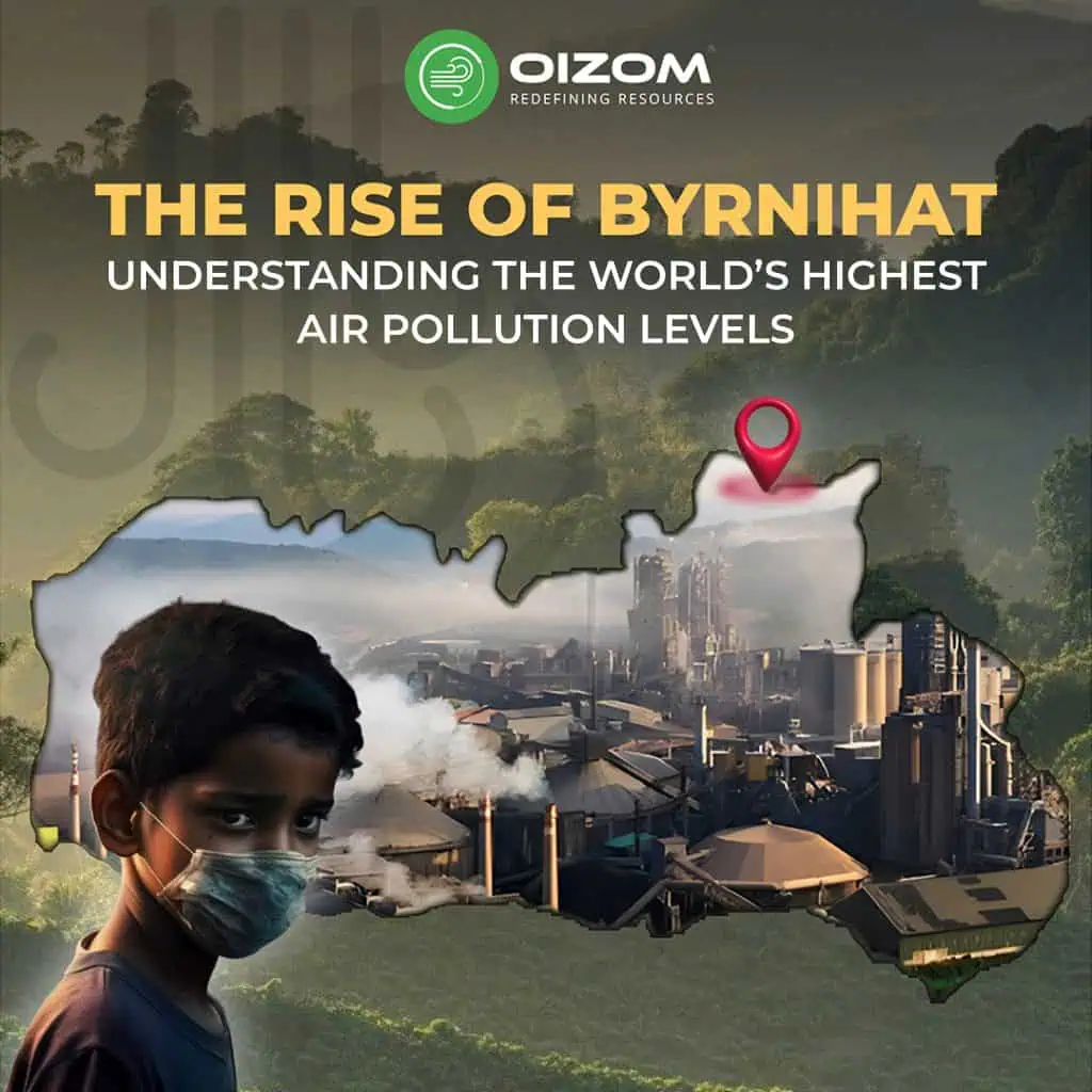
What comes to your mind when you think of the most polluted place on Earth? Maybe some busy metro city? Surprisingly, it’s not a city at all but a small industrial town tucked into the lush hills of Meghalaya: Byrnihat.
Bridging the Assam–Meghalaya border and nestled between hills and forests, Byrnihat recorded an annual average PM2.5 level of 128.2 µg/m³, over 25 times the WHO limit. This blog explores how a semi-urban settlement like Byrnihat became the world’s most polluted town as a result of rapid industrialisation, administrative complexity, topographical disadvantages, and lack of real-time monitoring.
We dive into its geography, industrial layout, and governance issues, while examining the impact on people, from health problems to disrupted livelihoods. The blog also questions common assumptions about the pollution’s sources, showing how even factory shutdowns didn’t improve air quality.
Most importantly, we highlight the urgent need for continuous, location-specific air quality monitoring as a way forward, enabling data-driven action in regions like Byrnihat
The Rise of Byrnihat: Understanding the World’s Highest Air Pollution Levels.
Byrnihat, a small industrial town on the Assam–Meghalaya border, recently became a global talking point not for economic growth or development, but for becoming the most polluted town in the world. According to the 2024 IQAir World Quality Report, the town recorded an annual average PM2.5 concentration of 128.2 micrograms per cubic metre, which is 25 times the World Health Organization’s recommended limit of 5 micrograms per cubic metre.
What is even more concerning is that Byrnihat’s scale (being a semi-urban settlement surrounded by hills, forests, and rivers) is the exact opposite of this news of pollution. To date, its residents continue to struggle with a daily reality where air quality remains hazardous year-round, visibility is often affected by dust, and basic routine activities like drying clothes outdoors or commuting are disrupted by pollution.
This blog explores how a town like Byrnihat, which is rarely talked about in mainstream media, became a case study of unchecked industrialisation, poor planning, and regional complexity. Through data and on-ground developments, we delve into the deeper causes and consequences of this growing crisis.
Byrnihat at a Glance: Geography, Industry, and Governance
Geography
a. Location-Boundry:
Byrnihat is a semi-urban settlement situated along the inter-state border of Assam and Meghalaya in Northeast India. It is about 20 kilometers from Guwahati and 65 kilometers from Shillong. The town falls under two administrative regions: Ri-Bhoi district in Meghalaya and Kamrup district in Assam. This dual jurisdiction places Byrnihat under the authority of two state governments and their respective pollution control boards.
b. Topography:
Byrnihat is situated in a narrow valley corridor, bordered by the Meghalaya hills to the south and the Assam plains to the north. This natural setting gives the town a bowl-like topography, which plays a significant role in its air quality crisis. Byrnihat’s terrain restricts airflow, causing emissions from industries, vehicles, and construction to remain trapped close to the surface. The surrounding altitude also blocks existing winds, limiting pollutant dilution and resulting in persistent build-up of particulate matter (PM2.5 and PM10).
c. Climate:
Byrnihat experiences a humid subtropical monsoon climate, with summer peaks up to 35°C and winter drops to around 10°C. The area receives abundant rainfall, particularly between June and September, averaging over 2,000 mm annually. Though monsoon showers help settle airborne dust and lower PM levels temporarily, data shows that Byrnihat’s pollution levels remain high even during rainy periods, often dropping only slightly (by 10–15%) before spiking again.
The town is also located near the Umtrew River, which now faces contamination risks from industrial effluents. Despite being surrounded by forests and natural vegetation, Byrnihat’s air quality continues to decline due to rapid industrialisation, weak enforcement, and its vulnerable topography.
d. Natural Features at Risk:
Byrnihat’s natural landscape, once defined by the Umtrew River, surrounding forests, and farmland, is under strain. Industrial waste has polluted the Umtrew, affecting water quality and irrigation. Deforestation and hill-cutting are disrupting local ecosystems, increasing soil erosion and dust levels. Additionally, airborne pollutants are settling on crops and grazing areas, reducing agricultural productivity and impacting livestock health.
e. Strategic Importance:
Byrnihat lies along National Highway 6 (NH-6), an important corridor connecting Assam with Meghalaya and the rest of Northeast India. Its proximity to major cities makes it a natural choice for industrial development, logistics, and warehousing. As a result, Byrnihat functions as a transit hub, with a high volume of commercial vehicle movement, including heavy trucks and goods carriers.
Impact of Pollution on People
1. Health Effects
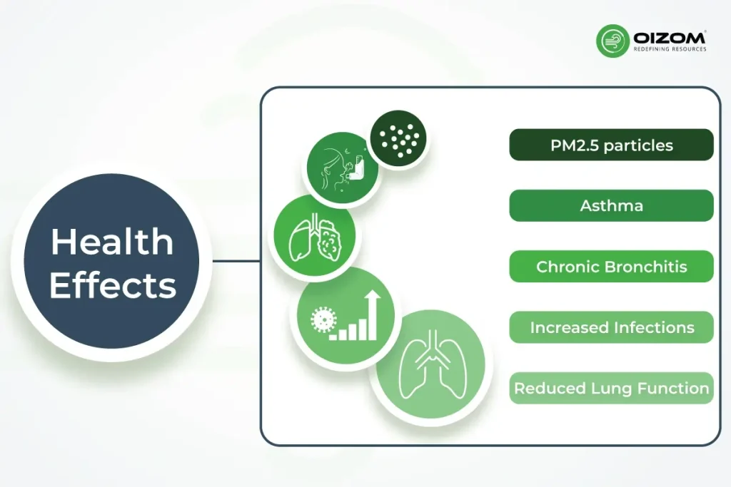
Byrnihat’s air pollution has triggered a sharp increase in respiratory issues. Government data shows respiratory infection cases rose from 2,082 in 2022 to 3,681 in 2024. Residents often report symptoms like persistent coughing, breathlessness, skin rashes, and eye irritation, all linked to prolonged exposure to fine particulate matter (PM2.5) in the air.
How Air Pollution Affects the Body:
- PM2.5 particles can penetrate deep into the lungs and enter the bloodstream, leading to severe respiratory and cardiovascular issues.
- Asthma: Air pollution irritates airways, triggering frequent and severe asthma attacks.
- Chronic Bronchitis: Long-term exposure causes wheezing, mucus buildup, and reduced breathing capacity.
- Increased Infections: Polluted air weakens the lungs, increasing risk of pneumonia and bronchitis, especially in children and the elderly.
- Reduced Lung Function: Over time, pollution damages lung tissue, making routine physical tasks like walking or climbing stairs difficult.
2.Livelihood Disruptions (DUST ACCUMULATION ON CAULIFLOWER)
Air pollution in Byrnihat has begun affecting farming; several farmers have reported that vegetables, especially cauliflower, are unable to grow properly due to dust accumulation from nearby industrial activity. The crops either dried up or turned black, making them unsellable. Betel nut quality has also declined, and in some cases, livestock have fallen sick after consuming contaminated grass.
For many daily-wage workers, poor outdoor visibility, dust-laden worksites, and health issues have led to lost workdays and inconsistent income.

3.Daily Life Under Strain
In Byrnihat, pollution has now become a part of daily life. Residents frequently report challenges like dust settling indoors (despite closed windows), difficulty drying clothes outdoors, and irritation of the eyes and skin. Even routine activities such as walking to work or school mean travelling on dusty roads.
Most people rely on shared autorickshaws to access the main highway and nearby towns. Factors like unpaved roads, construction work, and a high volume of freight traffic contribute to elevated dust levels, especially during dry weather.
The town’s unique location and shared jurisdiction can sometimes create administrative challenges in coordinating infrastructure upgrades or environmental management.
Industrial Landscape in Byrnihat
Byrnihat, though small in size, has rapidly evolved into a key industrial hub along the Assam-Meghalaya border. Its location along (NH-6) has made it a strategic choice for manufacturing units, many of which fall under the Red Category, indicating high pollution potential.
Industrial Presence at a Glance
- Total Units: ~80 operational industrial units in the greater Byrnihat region
- Meghalaya Side (13th–14th Mile, EPIP area):
- 5 Red Category industries
- 7 units were shut down in early 2025 due to violations (e.g., malfunctioning emission control devices, failure to share emission data)
- Assam Side (Burnihat Industrial Area):
- Designated as a Critically Polluted Area (CPA) by CPCB
- Houses 20 Red Category industries nearly four times more than Meghalaya
- Though not in Meghalaya, pollution from this area affects Byrnihat because it’s nearby and shares the same air.
Pollution-Driven Industrial Closures
Due to rising pollution levels and Byrnihat being labelled the world’s most polluted town, the Meghalaya State Pollution Control Board (MSPCB) initiated factory shutdowns during:
- Sept 3 – Oct 15, 2024
- Jan 29 – Mar 12, 2025
Cause of Closure:
- Ineffective or non-functioning emission control systems
- Excessive pollutant discharge
- Lack of online emissions monitoring
Impact of the Shutdowns
Despite these measures, the outcomes were mixed:
1. Air Quality Didn’t Improve
Air quality data from CPCB’s SAMEER app showed that the AQI remained in the ‘Severe’ range (300–400) even during shutdowns. Surprisingly, AQI was occasionally better during operational periods (e.g., August and November 2024), raising doubts about the assumed role of industry as the primary contributor.
2. Significant Economic Disruption
Repeated closures disrupted local industries, affecting production, financial stability, and workforce retention. The Byrnihat Industries Association (BIA) raised concerns over sustainability amid prolonged halts.
3. Need for Deeper Investigation
The shutdowns ineffectiveness pointed at the need to properly study where the pollution is really coming from. Experts increasingly point to road dust, diesel emissions, and construction activities, especially from Assam’s side, as substantial contributors.
The Monitoring Gap: Why Real-Time Data Matters
Even as Byrnihat grabs global headlines for its air pollution, one key issue continues to block effective steps: the absence of continuous and localized air quality monitoring.
Inconsistent Data, Blurred Reality
Different sources report different levels of air pollution in Byrnihat:
- Some reports suggest that average PM2.5 levels crossed 128 µg/m³ in 2024, over 25 times the WHO’s safe limit.
- Other datasets show much lower average concentrations, leading to confusion over the actual severity.
These disruptions can come from differences in monitoring locations, frequency of sampling, and methods used. Especially in regions affected by multiple sources and dynamic wind conditions.
Oizom’s calibrated devices like Polludrone and Dustroid provide accurate, real-time data, ensuring reliable insights even in complex, multi-source environments.
Why This Matters
Without accurate real-time data:
- Authorities, stakeholders struggle to identify pollution hotspots.
- The effectiveness of measures like industrial closures or traffic restrictions remains unclear.
- It becomes harder to distinguish between pollution originating from point sources.
Public awareness remains low, without access to real-time data.
Real-Time Monitoring as a Solution
Byrnihat’s pollution challenge is made more complex by:
- Its location on the border of two states,
- A high volume of truck traffic along NH-6,
- And a topography that traps airborne pollutants.
Real-time, continuous monitoring is key to:
- Capture hourly variations in air quality,
- Support evidence-based policy decisions,
- Enable emergency response in case of pollution spikes,
- Empower local communities with transparent, reliable information.
Enabling Smarter Interventions
Advanced environmental monitoring systems now provide high-resolution data tailored for mixed-use, semi-urban areas like Byrnihat. For instance, solutions like Oizom’s Dustroid specialize in monitoring particulate pollution in industrial and construction-heavy zones, while Polludrone offers multi-pollutant tracking including PM2.5, PM10, NO₂, SO₂, and VOCs enabling a more complete air quality profile.
Features such as humidity correction, real-time data transmission, and anti-static inlets make these systems especially effective in regions with high humidity and dust loads exactly the kind of conditions Byrnihat faces daily.
Whether it’s tracking nighttime truck emissions, measuring cross-border differences, or identifying hyperlocal pollution hotspots, intelligent monitoring systems offer the clarity needed to act, not just react.
Conclusion
Byrnihat’s story serves as a wake-up call for the need for timely action, better planning, and smarter tools. What was once a lesser-known industrial corridor is now the epicenter of pollution and conversations surrounding air quality, infrastructure, and cross-border accountability.
Its alarming rise in pollution places it among the world’s most polluted cities, highlighting the urgent need for sustainable intervention. But even in this grim reality, there is room for optimism. Change begins with clarity, and that starts with reliable data.
Innovative solutions like Oizom’s AQBot and Dustroid, which specializes in particulate matter monitoring, offer actionable insights in pollution-heavy zones like Byrnihat. Platforms such as Envizom make it possible to analyze trends, identify hotspots, and share live data with stakeholders from industries to regulators.
These tools empower decision-makers to go beyond reactive closures and take actions proactively. Because the road to cleaner air isn’t paved with assumptions built on evidence. And in towns like Byrnihat, that clarity can make all the difference.